Ride of the Month: Murray Bridge to Mulgundawa and back
Dale Manson invites keen road cyclists to try a longer route, the "wildlife loop".

This post was contributed by Dale Manson.

Not all cycling routes are suited to everyone.
Across the Murray Bridge cycling community and visiting bike riders, many people look for different things in their rides.
While the “wildlife loop” is a longer, bitumen-based ride for keen road bike riders, it is also suited to those who want to take their time riding the 65-kilometre route.
It can be a bit of a challenge, with a climb of 400 metres over the ride’s distance and the occasional head wind, particularly in the afternoon, when a southerly seems to come straight off Lake Alexandrina.
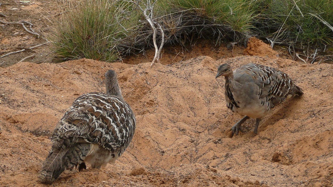
Despite this, the ride takes in some amazing farming country, the Mulgundawah salt harvesting fields and wildlife in the 880-hectare Ferries McDonald Conservation Park.
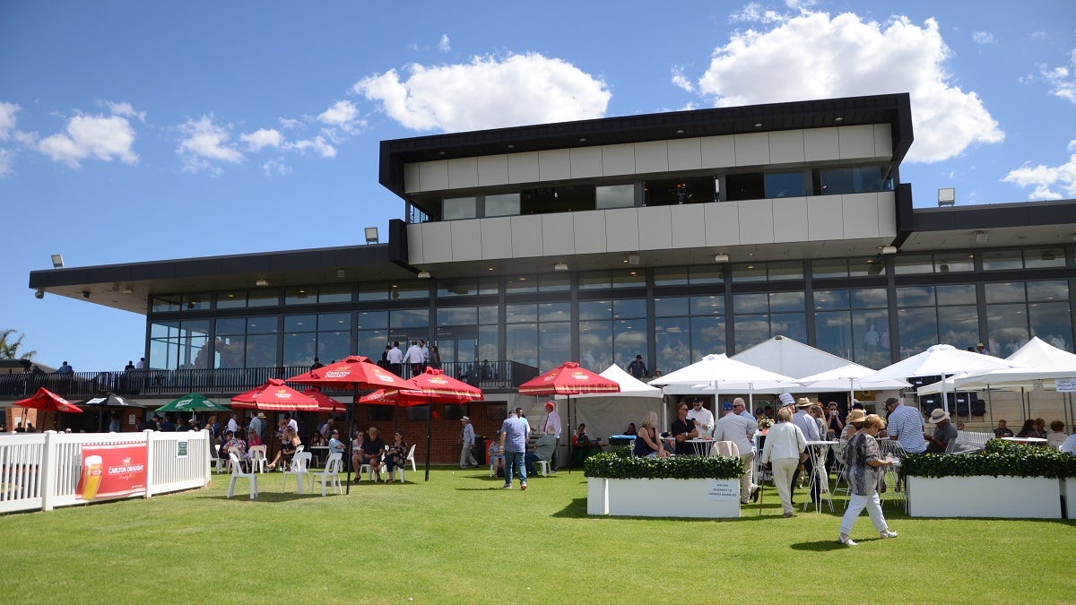
Early on, the ride passes the magnificent new Murray Bridge racecourse and horse agistment paddocks at Gifford Hill.

The starting point for the ride is the main street of Murray Bridge: Bridge Street.
From here, it’s an easy ride to Swanport Road, then right onto Mulgundawah Road at the hospital roundabout.
After passing under the South Eastern Freeway bridge and heading due south, Mulgundawah Road turns into Brinkley Road and passes the Gifford Hill racecourse, Brinkley Hall and Mulgundawah salt fields, eventually coming to the T-junction with the Langhorne Creek to Wellington road.
After turning right, toward Langhorne Creek, Kangaroo Road comes up on the right.
Riders should take this; they will notice the massive Peats Soils composting depot on the left-hand side part of the way along.
This road soon turns into Ferries McDonald Road, leading due north to the freeway overpass.
Ferries McDonald Road runs straight through Ferries McDonald Conservation Park, which serves to highlight natural vegetation and wildlife such as the malleefowl and kangaroos that have existed in the area well prior to settlement by the farming community.
Cross the freeway bridge and, just before hitting the Monarto South town settlement, cyclists should take a sharp right turn up Whites Road, past the poultry sheds.
Local cyclists call this stretch of the ride the “chicken run”.
White Road terminates at the Old Princes Highway, and another right-hand turn onto that highway leads to a T-junction at Adelaide Road, Murray Bridge.
A left turn here will provide cyclists with a tremendously exhilarating downhill ride to Bridge Street, in the centre of Murray Bridge, where the ride began 65 kilometres previously.
Previous ride of the month
You can help keep local features like this one free for everyone to read. Subscribe to Murray Bridge News today and support your independent, locally owned news service, plus get access to exclusive stories you won’t find anywhere else, from just $5 a month.