How Murray Bridge survived the 1956 flood – in pictures
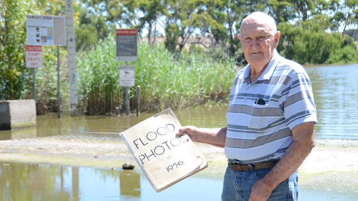
Ken Wells remembers well the biggest flood in the River Murray's modern history, thanks to a scrapbook he compiled at the time.


This post was originally published behind Murray Bridge News’ paywall. Paywalled posts are unlocked four weeks after publication. Can’t wait that long? Subscribe here.
Drive down Long Island Road, in Murray Bridge, and you just might spot it if you know where to look.
Near the base of one of the stobie poles on the right-hand side, towards the bottom of the hill, you’ll see a painted line and the words “56 flood”.
Local resident Ken Wells knows the spot well.
He first marked that pole as a lad of about 22, those 67 years ago.
It’s not the only memory he kept of the most significant flood in modern history, either – see the photos below.
By the time the river inundated his father’s market garden, young Ken had already been a keen scrapbooker for years.
He’d started in the days after his grandfather took him to Adelaide Oval to see Don Bradman play.
Bradman had got out for a duck late on the Saturday, to the schoolboy’s great disappointment; but then Keith Miller had belted the first ball he faced over the old Victor Richardson Gates for six, in Mr Wells’ memory, and went on to score his first test century.
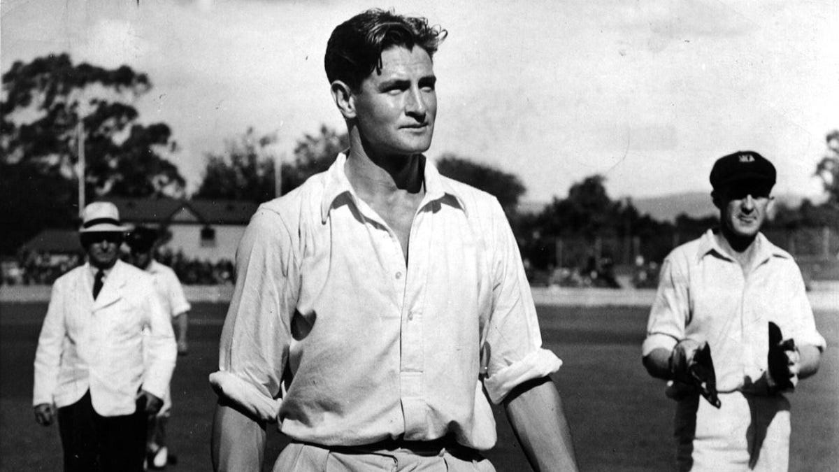
The outing made such an impression on young Ken that he cut out all the photos he could find of the day’s action and started a life-long hobby.
When the Olympic Games came to Melbourne, he wrote to all the big newspapers in the city – The Argus, The Sun News-Pictorial, The Herald – asking for copies of their every edition, right through the games.
Sure enough, six weeks after the closing ceremony, a tea chest arrived at the Murray Bridge railway station, piled high with copies, all free of charge.
Right around the same period, word started to filter down the river that something big was coming.
“Everything was filling up in the backwaters up river,” he said.
“Then in about autumn, about April or May, there were rumours we were going to have a bigger river; then it just rained and rained and rained in New South Wales and Queensland, and there was only one way out.”
In time, of course, there was no escaping it.
He kept every photo he could find from The Advertiser, The Murray Valley Standard, The Murray Pioneer and The Southern Argus.
He even featured in at least one.
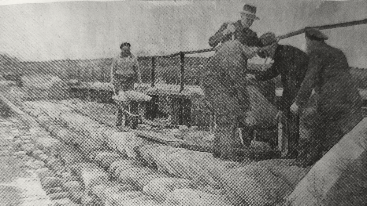
That’s him just to the left of centre in the photo below, all in white and with his backside facing the camera, helping others reinforce a failing embankment at Alf Kuchel’s place at Mypolonga.
At different times he drove a truck full of construction supplies around the district, including along the top of the levee at Monteith.
He rushed down to Jervois the night the levee broke there, too.
A siren went up late in the evening and every able-bodied man within cooee got out to try and shore up the bank, torches scouring the darkness for the source of the running water they could all hear.
He wasn’t the only one in his family keeping a record of it all, either.
His sister meticulously documented the status of the reclaimed irrigation areas along the Lower Murray: how many settlers and head of dairy cattle were on each swamp, what date the levees had breached, how much water had been pumped out afterwards and how long it had taken.
There was no good news for today’s irrigators on that page of Mr Wells’ scrapbook.
It took between seven and 11 months to pump almost 10 billion gallons of water off the swamps between Cowirra and Jervois.
What lessons could younger residents learn from the 1956 flood, then?
Mr Wells drew one chilling parallel.
Early on, this summer’s floods had reminded him of another year on the Lower Murray: not ‘56, but 1955.
Then, as now, the whole Murray-Darling Basin had had a wet few years, and by the time the big rains came much of the country had already been waterlogged.
Of course, the river system was different back then: “we never had the pipelines going to Adelaide; we never had the big irrigation they’ve got today, only on the swamps and the immediate high land, we never had it sucked out of the system; and no-one could tell us how high it was going to get”.
Did he think it was possible we might get wet again sometime during the next 12 months?
“It all depends what we’re going to have in another two or three months up in the catchment area,” he said.
“There’s still water up the top end – it’s still monsoon season up there.
“The Darling, they’re still in flood.”
Hopefully this time, though, he will be able to keep his paintbrush dry.
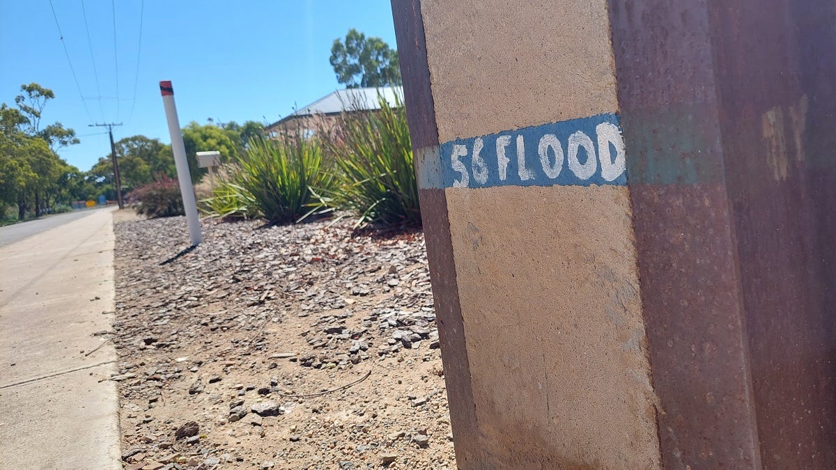
Photo captions
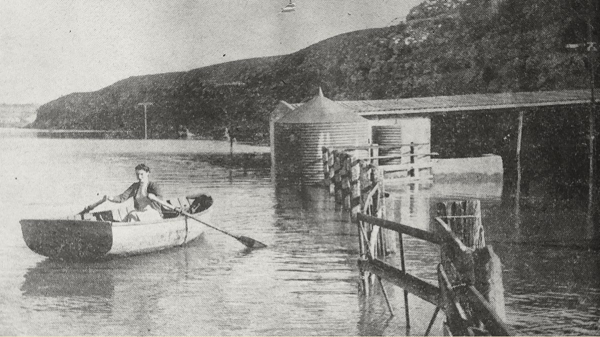
- Flooded shacks at Murray Bridge.
- Ivan Medhurst, H. Page, E. Kavolis, M. Ritter and J. Trewartha lay sandbags on the Mobilong levee.
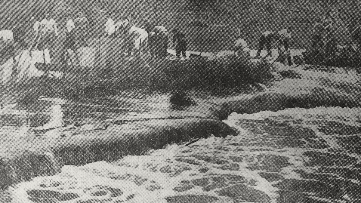
- Workers endeavour to close a 15-yard gap in an embankment at Mypolonga, shortly before being called off as the situation became too dangerous.
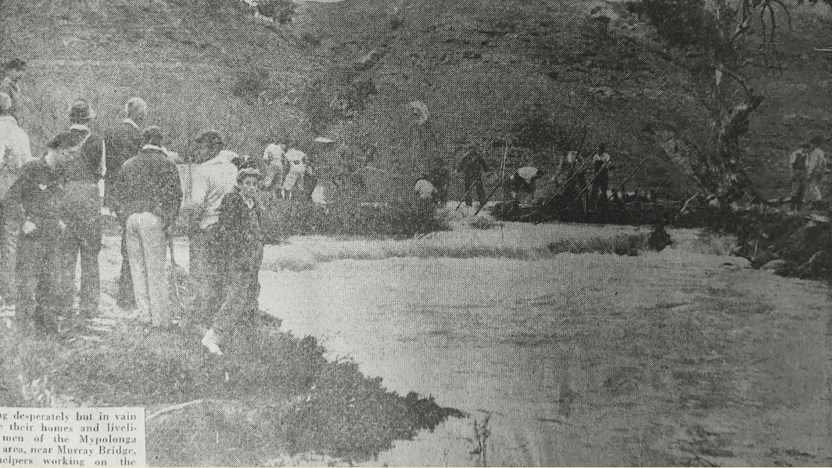
- Men from Mypolonga fight in vain to save their homes and livelihoods after an embankment breached.
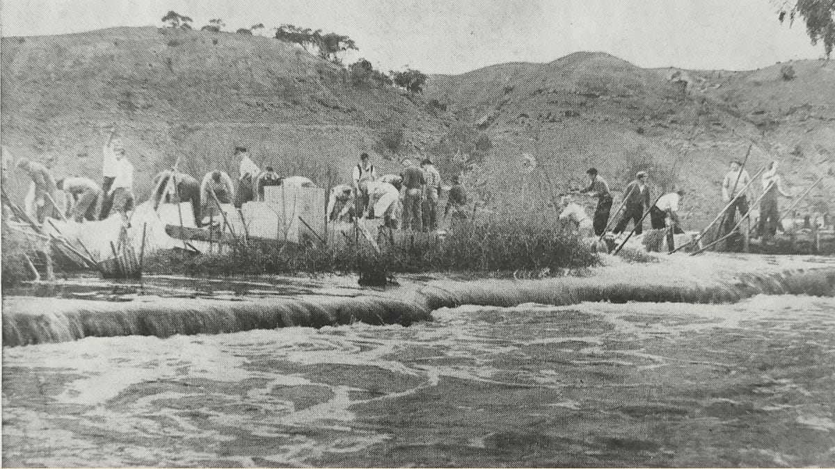
- Men from the irrigation board breach a levee at Woods Point to relieve the pressure on other levees nearby.
- Floodwaters pour through a breach in the levee at the Point, eight miles from Murray Bridge.
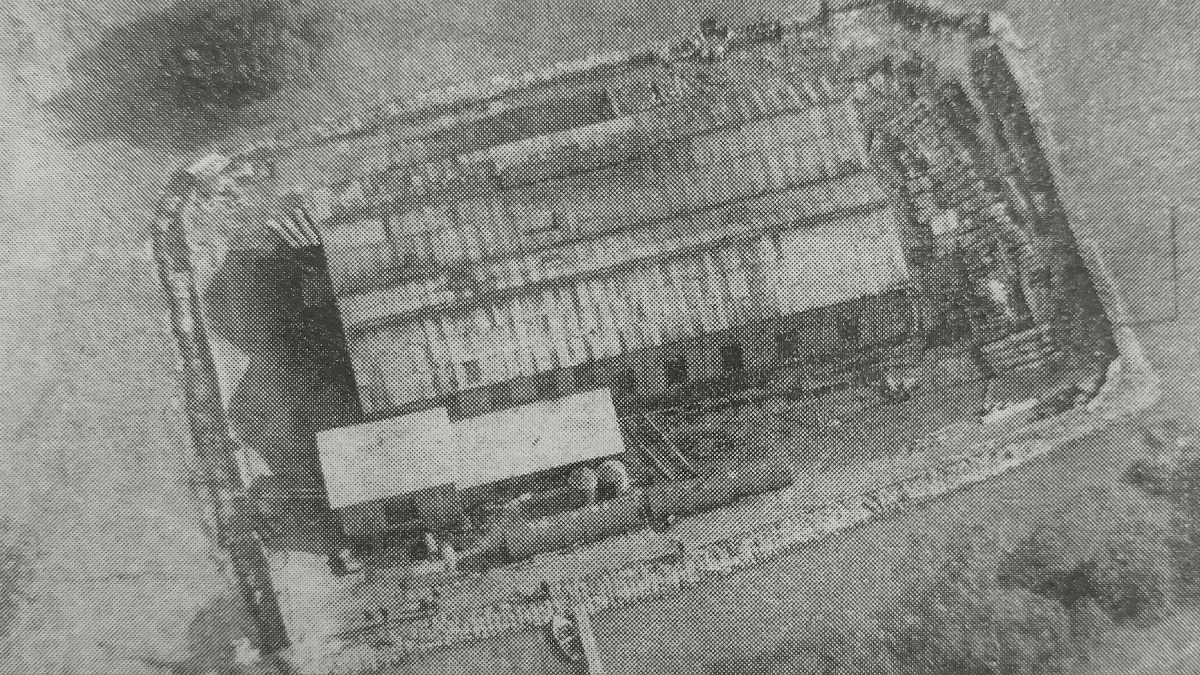
- From the air, the Mypolonga pumping station – protected by sandbag levees 12 feet high – looks like a barge.
- Floodwaters break through a levee protecting Sturt Reserve, Murray Bridge.
- An aerial photo of Jervois, before the levee broke, shows the river level 15 feet above the pastures.
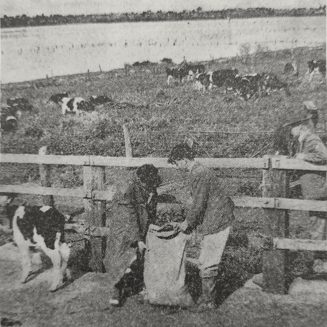
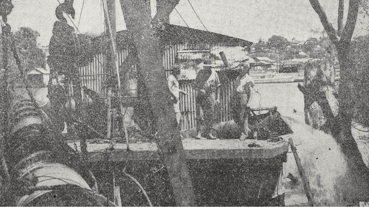
- Volunteers start building a new levee around A.C. Dodd’s milking shed as floodwaters creep over the Jervois irrigation area following a levee breach.
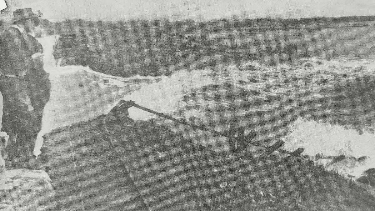
- Onlookers inspect a 100-foot breach in the Jervois levee, which had been the last one holding along the Lower Murray; a light railway line used during its construction and repairs is swept away.
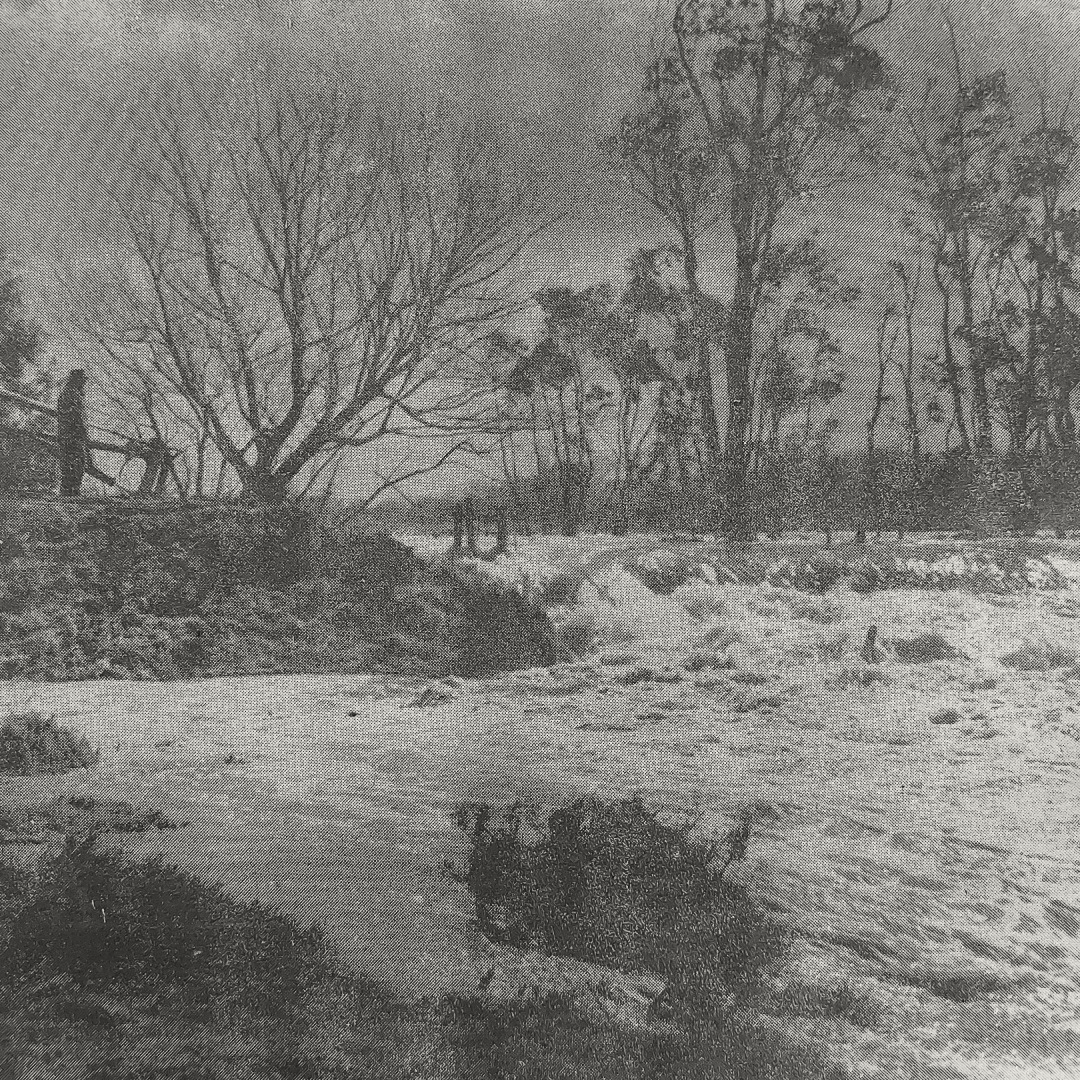
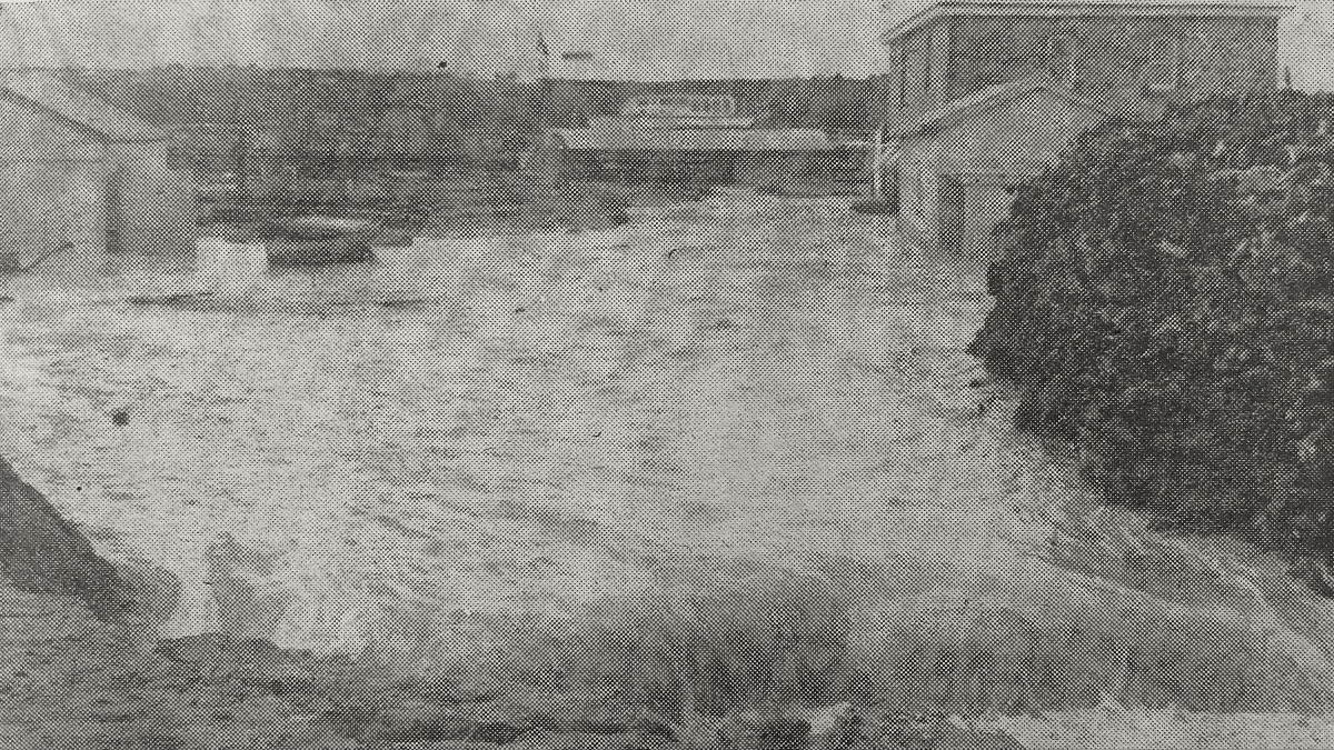
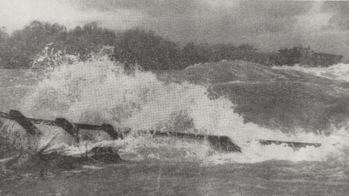
- A terrifying wall of water pours through a break in the Jervois levee.
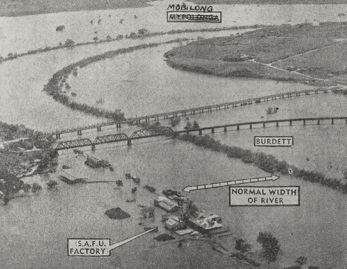
- Flood-affected Murray Bridge, with the Mobilong swamp in the background, Burdett swamp to the right and the abandoned SA Farmers’ Union factory at the bottom of the photo.
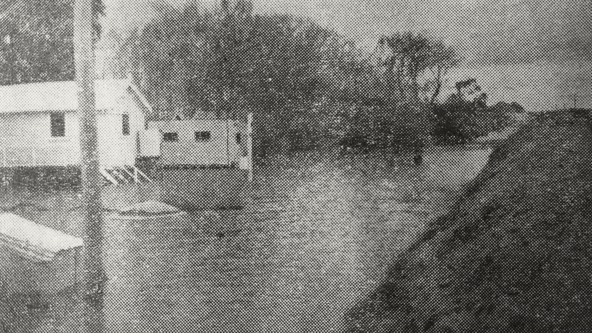
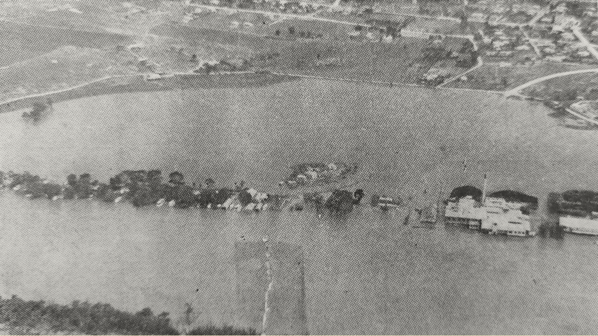
- The SA Farmers’ Union factory at Murray Bridge is isolated by floodwaters; many of the nearby shacks remained occupied, and their owners used boats to maintain contact with the town.
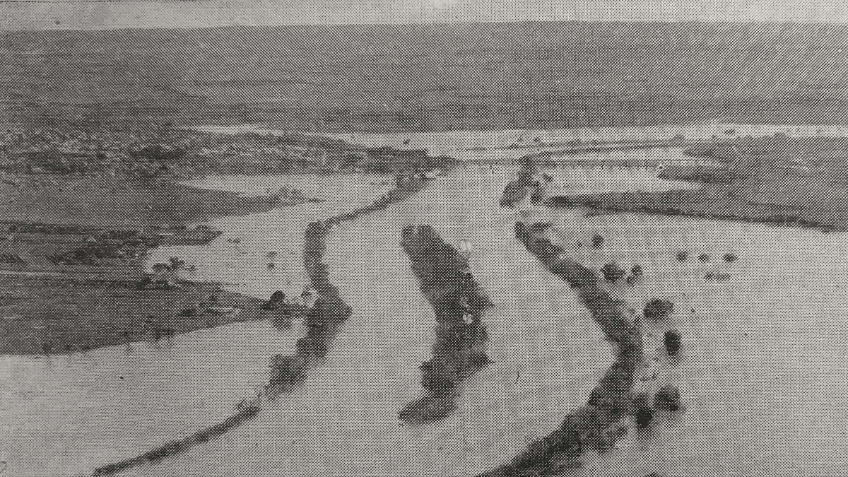
- This photo, taken from an Auster aircraft piloted by Ray Hannan, three miles south of Murray Bridge at 2000 feet, shows the extent of the flood.
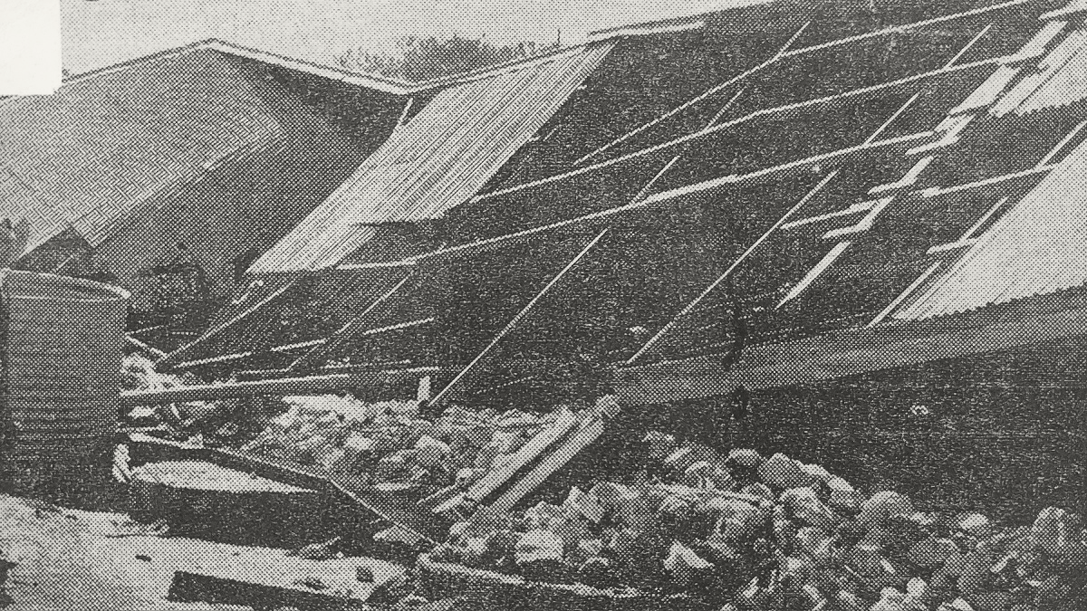
- The remains of a packing shed on the Mypolonga property of Mr C.H. Pinchers.