Walk of the month: Swanport Wetlands, Monteith
Graham Hallandal invites you to take a surprising walk on Murray Bridge's doorstep.

This post was contributed by Graham Hallandal.
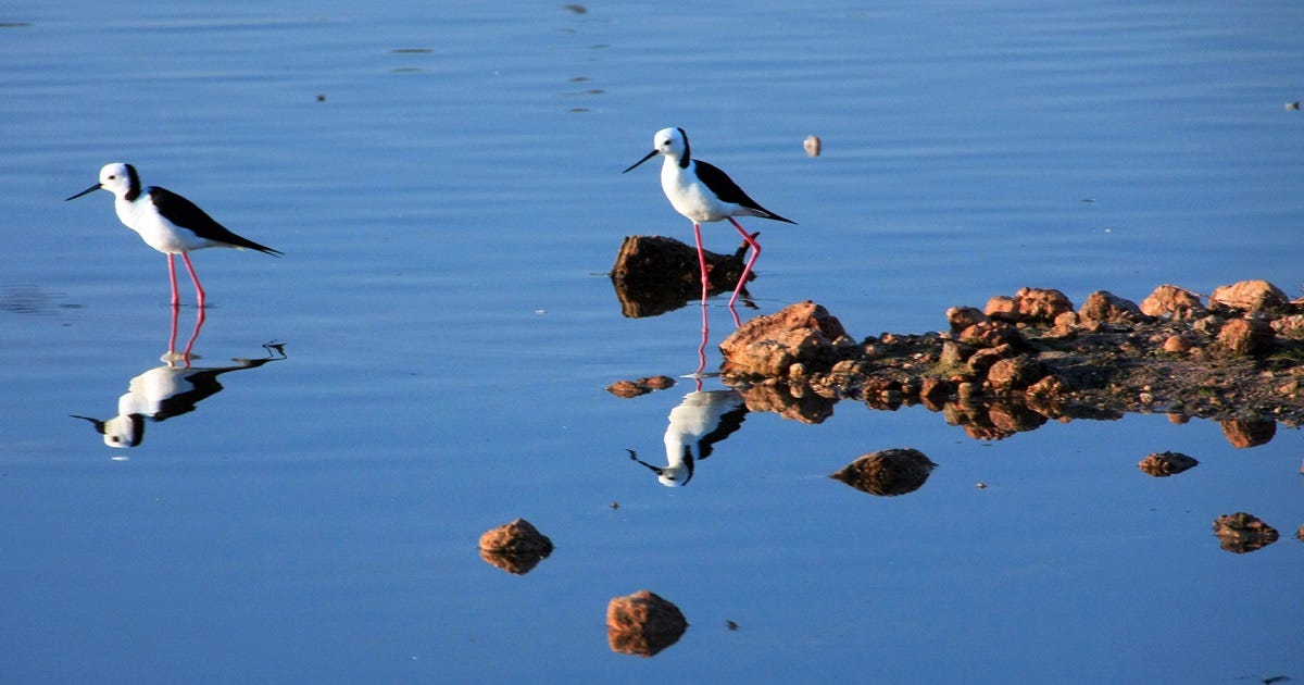
The Swanport Wetlands are one of those hidden gems unknown to most of the local community.
This is an area well worth the visit by people of all ages and abilities – most of the area is easily accessible by the physically disabled, including wheelchair access.
Located on the eastern banks of the River Murray adjacent to the Swanport Bridge, the wetlands are a recreational reserve under the control of the Rural City of Murray Bridge.
Access to the wetlands is from the freeway on the eastern side of the Swanport Bridge, with signs indicating access to the wetlands via the Frank Jackman Memorial Lookout.
The lookout is worth a stop on the way out, remembering it is a one-way road.
It provides a great view of the Lower Murray landscape from green river flats, the increasing size of the Murray Bridge township and nearby rural living developments through to the eastern Mount Lofty Ranges in the distance.
Take the track signposted “Swanport Wetlands” down the hill and below the Swanport Bridge to the car park.

An interpretive sign at the entrance to the wetlands is worth a look with a list of plant species, animals and birds of the area.
Miss Gawler Island, one of the lesser-known local islands, can be observed before entering through the swing gate into the reserve.
The wetlands are a nationally significant River Murray wetland.
A wide range of fish, mammals and water birds inhabit the area.
It is also a special place, having food and shelter, for the local Ngarrindjeri people.
It covers an area of more than 19 hectares, including 3.5 hectares of open water surrounded by bulrushes and club rushes within 13.5 hectares of wetlands.

The early history of the district is still on show as the wetland is essentially one lagoon which has been bisected by a causeway that provided access to an old river crossing that operated from 1866 to 1879.
A levee bank, originally overgrown with willows, separates much of the wetlands from the river.
This is a walk best enjoyed as a stroll, allowing time to be distracted and enjoy the abundant bird life – listen to their sounds.
More than 100 bird species have been observed over the years.
Stop, look and listen, don’t hurry.
Make your way along a well-formed track to the elevated undercover interpretive pergola.
Pause and listen to the bird chorus, a pleasant contrast to the traffic noise from the highway that gradually fades as you walk further into the area.
The elevated interpretive centre provides not only information on flora, fauna and a layout of the area but gives a panoramic view over the wetlands with seats to pause, listen and enjoy.

Toilets are located nearby.
The elevated area to the left as you enter the area was planted with local native vegetation in 1991.
More than 5000 trees were planted by local schools and volunteers as part of a revegetation project.
The revegetated areas are a haven for a range of active bush birds.
Several trails run through the area starting at the pergola, but are not wheelchair accessible.
In front of the pergola, a track leads towards the river.
A boardwalk to a seat looks across the water and loops back to the main track.

Further along the main trail, a seat with a screen with slots allows views of the bird life while screening the bird watchers.
Past the bird watch area the track becomes a boardwalk with a short access to a river landing.
If you have access to a boat, this is an alternative access to the wetlands.
Look for the footings of the Thompson Crossing ferry just downstream from the landing.
These footings have lain in the river mud for more than 100 years, a reminder that this river crossing pre-dates all the bridges at Murray Bridge.
Cattle were first swum across the river at this point in 1839 and in 1856 a landing chute and large punt were built to ferry sheep.
Leaving the jetty, head left and over the reed beds.
In this area, the dominant noise is of frogs, including the brown tree frog.

Complete the boardwalk circuit, taking time to explore all the side paths, including the one remaining elevated bird hide.
There were originally three bird hides in the area but two were removed, mainly as a result of vandalism.
You may be interested in knowing that the planks on the boardwalk are constructed using recycled plastic.
These are made up of 50 per cent sawdust and 50% recycled milk containers, needing 1200 to make one seat.
Further on, the trail reaches solid ground.
Finally, on the way back to the front gate, have a look at the dead trees with hollows to your left, and – from a distance, so not to disturb any animals – see if anyone is home.
Allow 90 minutes or more and don’t forget to take your camera and binoculars.
A pamphlet on the Swanport Wetlands is available from the Murray Bridge Visitor Information Centre on South Terrace.

Callington spur trail will open next month
Interested in walking or mountain bike riding and would like to know more?
The official opening of the latest trail in the area, the Lavender Federation Trail Callington Spur, will be opened on Saturday, September 12 at 10am near the truckers’ memorial on Adelaide Road, Murray Bridge.
View a photo display of trails, talk to the representatives from walking and mountain bike groups and pick up free trail brochures at the opening.
The information centre will be in attendance if you want information on local attractions.
The Rural City of Murray Bridge website shows all trails in the district at maps.murraybridge.sa.gov.au.
Photos: Graham Hallandal. Map: Rural City of Murray Bridge.


