Ride of the month: Monarto Woodland
Dale Manson guides you through the Monarto Woodland area on the top of Callington Hill.

Shared with avid bird watchers and horse riders, the Monarto Woodland area located on the top of Callington Hill offers year-round firm-surface riding for mountain bike enthusiasts of all ages and abilities.
Located on the northern side of the Old Princes Highway, directly across the road from the Olearia MTB Trail precinct, this part of the Monarto Woodland has been
dedicated to ornithological, or bird watching purposes.
Consequently, while mountain bike riding is welcomed along the already established fire tracks, there is a total prohibition on the development of formal MTB trails through other areas of this woodland area.
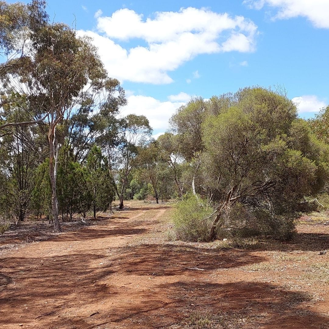
Nevertheless, the established fire tracks are well signposted and the lack of sandy
areas provides opportunity for year-round riding.
The difference between the terminology “track” and “trail” is of absolutely no
consequence.
Firefighters prefer the name “track”, while mountain bike riders prefer to call the
same routes “trails”.
In line with the bird-watchers’ paradise theme of the woodland scrub area, all the fire tracks are named after bird species such as Boobook, Kestrel, Wagtail and Nightjar.
The bonus is an absence of rocks, unlike many of the MTB trails located in the
nearby Kinchina Conservation Park.
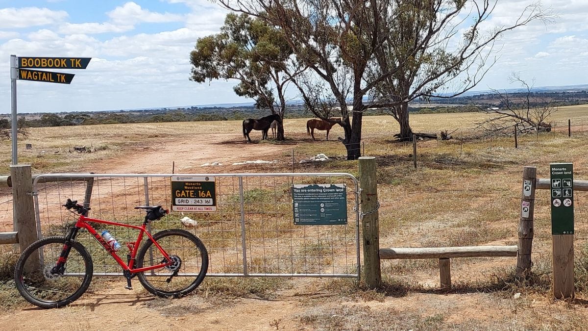
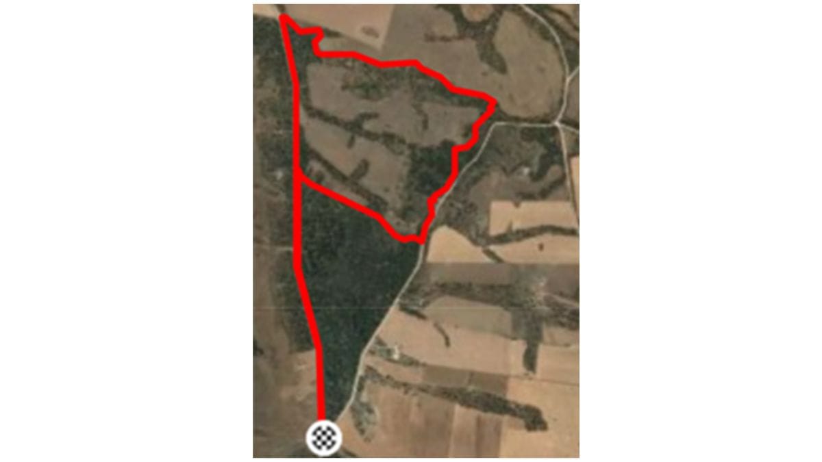
The best place to start the ride is at the intersection of Highland Road and Browns
Road on the Old Princes Highway.
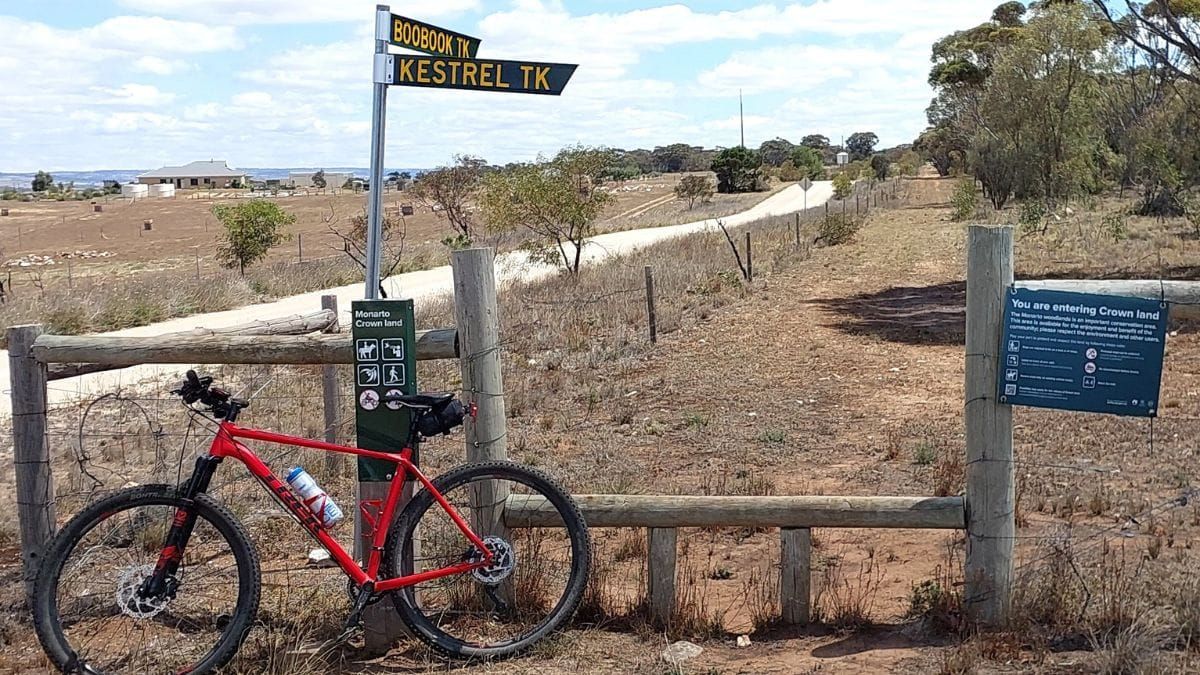
Lifting the bike over a step-over stile, there is a choice of riding along one of the two well signposted fire tracks, appropriately named Boobook Track and Kestrel Track after the local birdlife.
This particular ten kilometre MTB ride commences in a clockwise direction along the Boobook Track, which parallels Highland Road just outside the woodland’s boundary fence.
Riding along this fire track is good, but really only suited to mountain bikes.
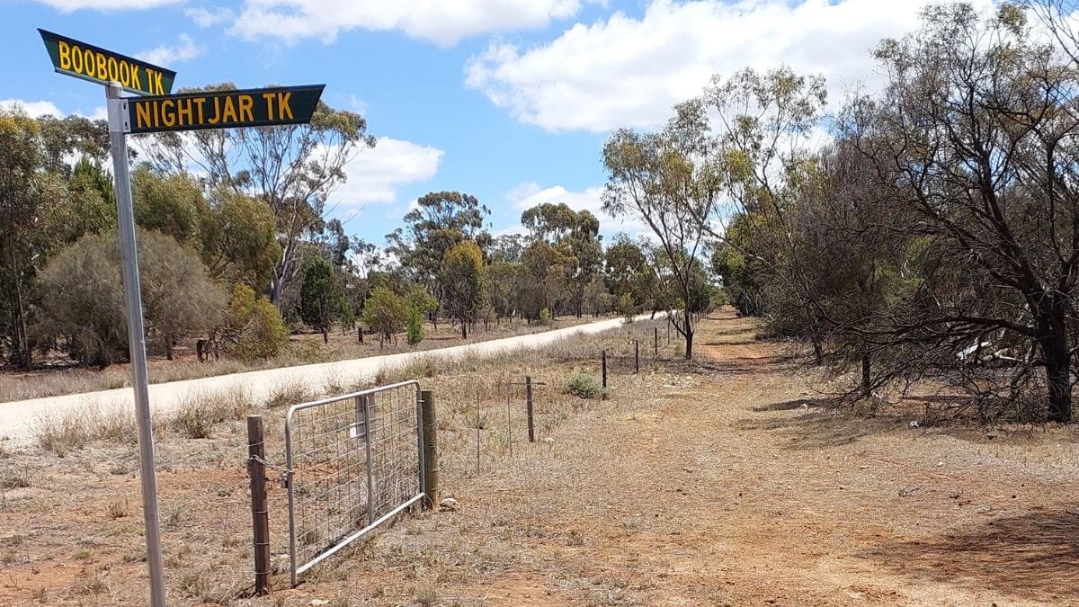
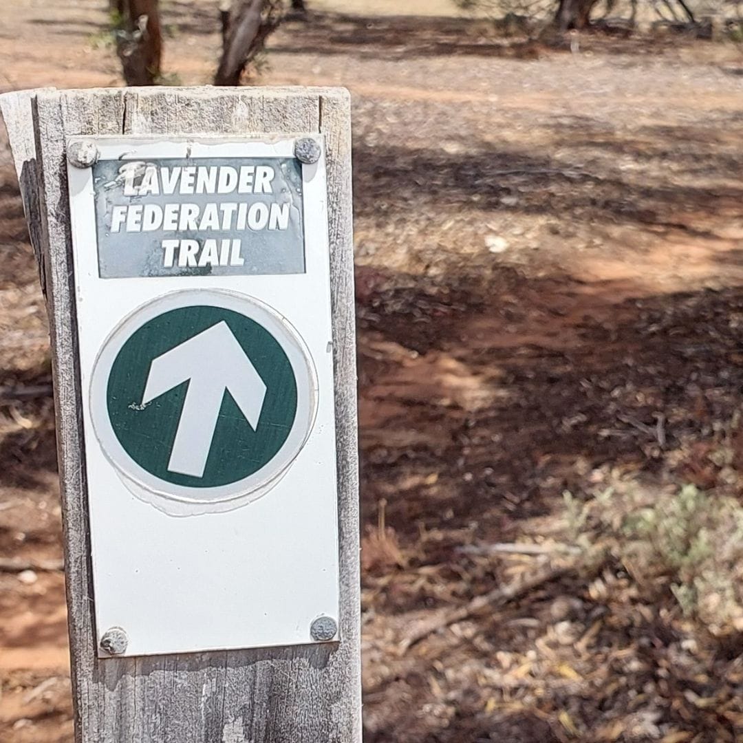
At the two kilometre point along Boobook Track, riders take the signposted Nightjar Track that heads off on the right hand side and into the centre of the woodland area.
However an option to turning into the Nightjar Track is to ride straight ahead on the Boobook Track for around one and a quarter kilometres to meet up with the
tremendous downhill section of the Lavender Federation Trail.
This ride takes in the Nightjar Track that extends for precisely one kilometre, meeting the Kestrel Track at the Browns Road boundary of the woodland area.
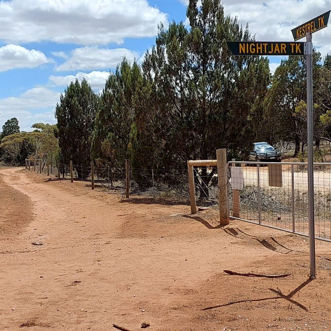
The wonderful all-weather surface of the fire track and the end of Nightjar Track, where it meets Kestrel Track. Photos: Dale Manson
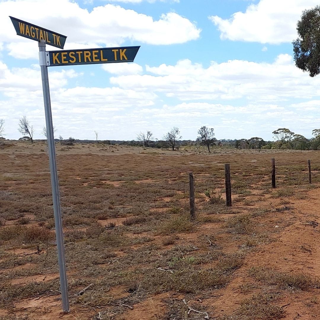
At this point riders turn left and head north along the Kestrel Track, weaving around patches of scrub for approximately one and a half kilometres.
This is quite a pleasant track to ride and offers quite a deal of variety.
Toward the end of Kestrel Track, it crosses the bottom of the downhill Lavender
Federation Trail.
The option here is to actually head west riding uphill along the Lavender Federation Trail toward Highland Road.
If heading uphill along the Lavender Federation Trail, riders need to be aware of
other MTB riders who may be heading downhill at speed, as well as the occasional
somewhat slower walking group using the trail.
The other option is to proceed a few more metres along the Nightjar Track and join
the Wagtail Track that parallels the Lavender Federation Trail.
This T-junction intersection is well signposted.
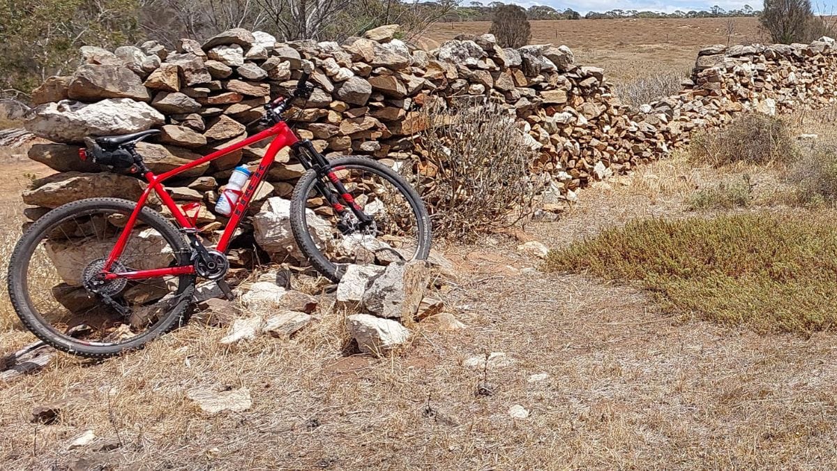
The northern most end of Kestrel Track and the land cleared by pioneer and Historic dry-stone wall erected by the original pioneer farmers of the area. Photo: Dale Manson
Over the wire fence running along Wagtail Track is an expansive area cleared of all
vegetation, a visual legacy of the region’s farming days prior to Government land
acquisition for the long-abandoned Monarto City initiative.
MTB riders head uphill in a westerly direction along Wagtail Track for two kilometres.
Partway along Wagtail Track can be found another legacy of early farming days, a
historic drystone wall.
The top end of Wagtail Trail meets Highland Road, Boobook Track and the start of
the Lavender Federation Trail downhill.
Another choice needs to be made here.
Head back in a southerly direction to the day’s starting point just over three
kilometres away riding the smooth surfaced Highland Road, or using the slightly
rougher Boobook Track.
While this MTB ride works out to a 10-kilometre circuit, it can be extended or
reversed in direction, depending on desire and ability.
A bonus of this ride is the panoramic view of the beautiful Bremer Valley around
Callington from the ride’s start and finish point.
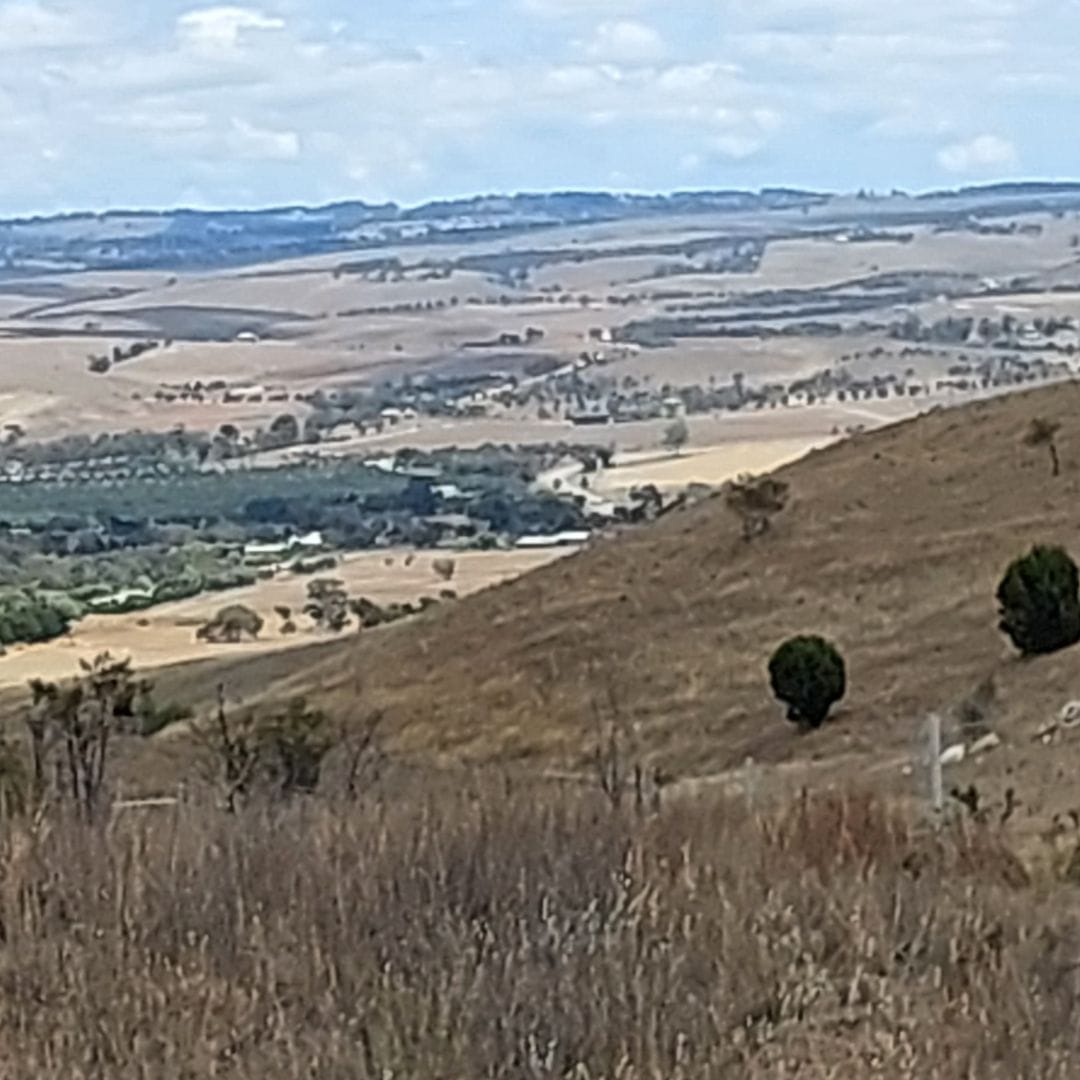
The panoramic view of the beautiful Bremer Valley adjacent to Callington. Photos: Dale Manson